The trail that starts from the Rucurto Bridge, is undoubtedly the most popular one, it winds through the woods, with spectacular views on the Tofana di Rozes, Cinque Torri, the Averau and Nuvolau mountains.
How to get to Croda da Lago: The path in detail
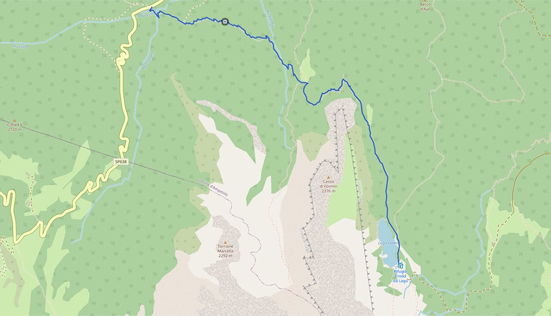
Description: the starting point is the Rucurto Bridge on the SP road 638 of the Giau Pass, 1708 meters above sea level. Here is the start to the trail number 437, that is to be followed up to the intersection (Cason di Formin) with trail number 434 that leads to the Croda da Lago mountain hut.

As well as the trail that starts from the Rucurto Bridge, there are several other alternatives that take you to the Croda da Lago mountain hut. Consider your level of fitness, altitude difference and hiking time. Some of the most interesting itineraries are described below.
From Campo di sotto
From Campo di Sotto in Cortina d’Ampezzo, follow the paved road, trail marker 432. From Malga Federa, this becomes a gravel road leading up to the Croda da Lago mountain hut.
In the summer 2019, a new trail was opened, linking the main paved road to Malga Federa, this is named ‘Gores de Federa’.
This is also a nice alternative to get to our mountain hut, but the significant altitude difference from Lake Pianozes needs to be considered.
This path is not only accessible in the summer, but also in the winter, when it is usually groomed and so it becomes ideal for sledging and ski mountaineering.

From Pezié de Parù
Peziè de Parù is located on the SP 638 road of the Giau Pass, shortly after Pocol. Here is the start of trail number 434, initially on a gravel road, it first leads to Cason di Formin and arriving at the Croda da Lago mountain hut afterwards.

From the Passo Giau
Here is how to get to Croda da Lago following another wonderful itinerary. From the Giau Pass, on trail n. 436, you can get to our mountain hut, walking through the marvellous mountain pastures of Mondeval. Here, the well-preserved skeleton of a prehistoric man dating back to 7500 years ago was found in the 80s. Click on this link to find out more about the Mondeval Man.
Once having walked past the Mondeval mountain pastures, one gets to Forcella Ambrizzola and carries on, on trail n. 434 for about 30 minutes.
A tip for those wanting to get to the Croda da Lago mountain hut from the Giau Pass and on trails 434 and 437 that lead to the Rucurto Bridge, is to get the bus that links Cortina to the Giau Pass.
The bus service is available from beginning of July until about 10th September. This will give you two options:
1. Drive to the Giau Pass, walk to the mountain hut and after getting back to the Rucurto Bridge, you can take the bus at 15:40, which will take you back to the Giau Pass and your car.
2.Getting the bus from the town of Cortina at 08:40 and at the end of your hike, you can get the bus again at 17:00 which will take you back to Cortina.
IMPORTANT: check the bus timetable, as the times outlined above are subject to change.
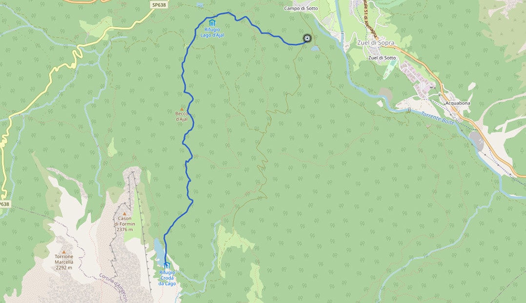
From Lake Ajal
From Cortina d’Ampezzo and more precisely Campo di Sotto follow the paved road (n. 432), direction to Lake Ajal (Lago d’Ajal) and keep on walking on the gravel road (n. 430) until you get to the lake. From here, take the trail n. 431 by the ‘Cason del Macaron’. This passes near the Beco d’Ajal rock and allows to quickly get to the Croda da Lago mountain hut.
From the Città di Fiume mountain hut
How do I get to the Croda da Lago mountain hut from the Città di Fiume mountain hut? From the mountain hut (1918 meters above sea level), take the trail n. 467, walk through and past Forcella de la Puina and then Forcella Col Roan. From here, take the trail n. 458 to Malga Prendera and then trail n. 436 to Forcella Ambrizzola. Now, after an easy downhill walk, one arrives at the Croda da Lago mountain hut, which is visible from Forcella Ambrizzola.

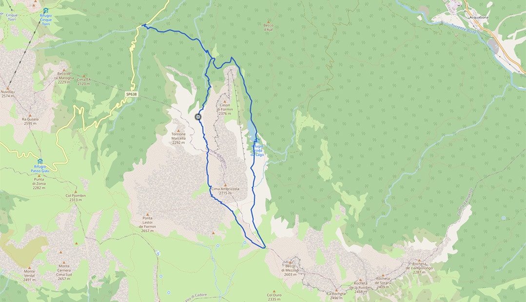
Croda da Lago loop
The Croda da Lago loop is undoubtedly one of the most rewarding itineraries from a geological and a landscape perspective. In fact, it starts in the wonderful woods, it continues uphill along the Val di Formin valley, goes through the gorgeous meadows of Mondeval to eventually arrive at the Croda da Lago mountain hut. Finally, it goes through the woods again, heading back to the Rucurto Bridge, where you would have parked your car.
Click on the following link to read the complete description of the Croda da Lago loop hike.